Glendale sits at the eastern edge of the San Fernando Valley, where the Verdugo Mountains rise sharply to an elevation of over 3,100 feet, creating a complex interface between alluvial fans and steep bedrock. Any subsurface investigation here must contend with the transition from recent Holocene deposits to heavily fractured crystalline basement. An exploratory test pit allows direct visual inspection of these contacts, revealing cobble lenses, paleosols, and slickensided clay seams that continuous sampling methods often miss. For projects near the Raymond Fault zone, which traverses the northern part of the city, the observational data gathered from a properly logged test pit becomes indispensable.
The method involves excavating a trench to depths typically between 5 and 15 feet, although OSHA Type C soil classifications govern maximum unsupported vertical cuts in Glendale's sandy alluvium. Our field geologists describe the exposed profile according to the Unified Soil Classification System under ASTM D2487, photograph each stratigraphic unit, and collect bulk samples for laboratory index testing. When foundation loads require bearing capacity validation at shallow depth, we often pair the visual pit log with a plate load test performed directly on the exposed bearing stratum, yielding in-situ modulus values that refine presumptive IBC allowable bearing pressures.
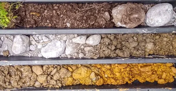
A well-logged test pit in Glendale's alluvial fan deposits reveals more about depositional history and potential collapsible soil behavior than a dozen SPT borings.
Scope of work in Glendale California
The excavation is performed with a rubber-tired backhoe or mini-excavator, and access constraints in Glendale's hillside neighborhoods—where narrow winding roads and retaining walls limit equipment size—require careful logistical planning. Once open, the pit face is cleaned with hand tools to expose undisturbed soil fabric, and our geologist measures joint spacing, infill material, and seepage zones. Disturbed samples are sealed in plastic bags for moisture content, Atterberg limits, and sieve analysis, while relatively undisturbed block samples can be carved from cohesive strata for laboratory strength testing. Documentation includes a scaled stratigraphic column, GPS coordinates tied to the project datum, and a photographic record with color scale cards, all assembled into a final report that serves as the factual basis for engineering recommendations.
Risks and considerations in Glendale California
The Mediterranean climate of Glendale—with hot, rainless summers followed by intense winter storm pulses—creates a pronounced shrink-swell cycle in the near-surface clayey soils that mantle the foothills. A test pit opened in September reveals a completely different moisture profile than one logged in February, and this seasonal variation directly affects the interpretation of bearing capacity and lateral earth pressures. Failure to account for the dry, cracked crust that forms during the summer months can lead to overestimation of shear strength parameters, a risk that becomes evident only after the first heavy rains saturate the ground behind a new retaining wall.
Collapsible soils present another regional hazard; loose, moisture-sensitive alluvial silts derived from the San Gabriel Mountains can lose significant volume upon wetting, and the test pit provides the undisturbed exposure needed to identify the honeycomb structure characteristic of these deposits. Our logging protocol specifically notes root penetration depth, desiccation crack patterns, and the thickness of the surficial disturbed zone, all of which inform whether shallow footings require overexcavation and recompaction or a deeper support system.
Our services
The exploratory test pit serves as the primary visual reconnaissance tool, and we integrate the findings with complementary field and laboratory services to build a complete geotechnical model for sites across Glendale.
Stratigraphic Logging and Sampling
Detailed pit face mapping per ASTM D2488 with disturbed and undisturbed sampling at selected horizons. Includes Munsell color notation, plasticity assessment, and groundwater seepage documentation for design-phase geotechnical reports.
In-Situ Density and Strength Verification
Direct measurement of compacted fill density using sand cone or nuclear gauge methods on exposed pit floor, combined with hand penetrometer or pocket shear vane testing to calibrate laboratory strength data against field conditions.
Common questions
How deep can you excavate a test pit in Glendale without shoring?
Under Cal/OSHA regulations, the maximum vertical cut depth in Type C soil—which includes Glendale’s common sandy alluvium and loose fill—is generally 5 feet for personnel entry without a protective system. For deeper inspections, we either slope the excavation at a 1.5H:1V ratio or use a trench box. The specific classification is determined on-site by the supervising geologist based on the actual soil conditions encountered.
What does an exploratory test pit typically cost for a residential project in Glendale?
For a standard Glendale residential site with accessible terrain, a single test pit with equipment mobilization, excavation to 8–12 feet, full logging, sampling, and a summary report typically ranges from US$510 to US$730. Costs increase when access is constrained by hillside lots, when deeper excavation through cobble-rich alluvium slows the operation, or when multiple pits are required to map lateral variability across the parcel.
Can a test pit be used instead of borings for a hillside foundation design?
A test pit provides excellent visual data for the upper 15 feet and is particularly useful for identifying fill boundaries, colluvial wedges, and shallow bedrock irregularity on Glendale hillsides. However, for deeper foundation elements like drilled piers or for liquefaction assessment, borings with SPT or CPT are still required to characterize deeper strata. The pit complements the boring program—it does not fully replace it—and the combined dataset yields the most reliable geotechnical parameters.