Glendale sits just 520 feet above sea level at the eastern edge of the San Fernando Valley, a basin with over 30,000 feet of sedimentary fill that amplifies seismic waves unpredictably. When the 1994 Northridge earthquake struck 12 miles away, neighborhoods across Glendale experienced wildly different shaking intensities, not because of distance but because of subsurface velocity contrasts. Seismic tomography cuts through that guesswork. By measuring P-wave and S-wave travel times from surface impacts, our field team maps velocity layers beneath your parcel, identifying soft clay pockets, irregular bedrock depth, and shear-wave velocity profiles that feed directly into ASCE 7 site classification. The result is a velocity cross-section that structural engineers in Glendale rely on to design foundations that match actual ground conditions. We complement these surveys with MASW when the project requires a broader 2D shear-wave velocity map, or with downhole SPT drilling to correlate tomographic boundaries with blow-count data at specific depth intervals.
Seismic velocity data turns ASCE 7 site classification from a regional guess into a parcel-specific measurement.
Scope of work in Glendale California
Risks and considerations in Glendale California
ASCE 7-22 requires Site Class determination for every new building permit in Glendale, and the City's building department enforces Chapter 16 of the California Building Code strictly. Guessing a Site Class D when the parcel actually qualifies as E can trigger costly foundation redesigns after grading exposes unexpected conditions. The risk is amplified along the Verdugo Fault trace and in liquefaction-prone zones mapped by the California Geological Survey near the Los Angeles River channel. Seismic tomography addresses this by measuring Vs30 directly rather than inferring it from blow counts or soil descriptions. A project that skips velocity measurement risks two outcomes: overdesign that wastes concrete and steel on an overly conservative Site Class, or underdesign that produces a structure vulnerable to amplified ground motion. For critical facilities, we also integrate liquefaction assessment using CPT data to evaluate cyclic stress ratios in saturated loose sands below the water table.
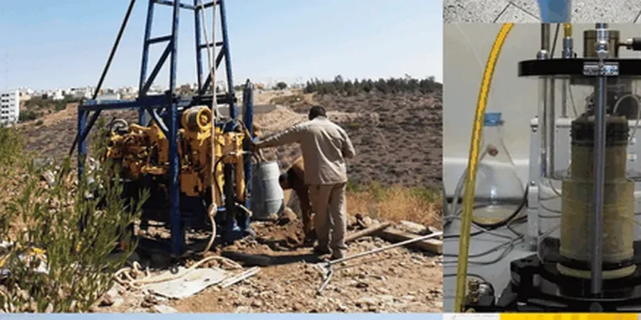
Our services
Our Glendale geophysical surveys address the subsurface questions that standard borings alone cannot answer. Each service below follows ASTM field procedures and includes velocity analysis, interpretation, and a stamped report ready for structural review.
Refraction Microtremor (ReMi) Surveys
Passive-source method using ambient noise and linear arrays to obtain Vs profiles down to 300 feet. Ideal for tight urban sites in downtown Glendale where active sources face logistical constraints.
Crosshole Seismic Testing
Direct measurement of Vs and Vp between two or three boreholes at matching depths. Provides the highest-resolution velocity data for critical infrastructure and hospital projects governed by OSHPD requirements.
Seismic Reflection Profiling
High-resolution CDP reflection surveys for imaging stratigraphic boundaries, fault offsets, and bedrock topography beyond 200 feet depth. Used for deep excavation planning and fault-rupture assessments near the Verdugo Fault zone.
Common questions
What is the typical cost range for a seismic tomography survey on a residential lot in Glendale?
For a standard single-family residential parcel with a 115-foot refraction spread, the cost typically ranges from US$2,920 to US$5,030, depending on access constraints, the number of shot points required, and whether passive-source ReMi data collection is added for deeper Vs profiling. Sites with heavy vegetation, steep slopes in the Verdugo foothills, or limited line-of-sight for cable layout fall toward the upper end of that range.
How does seismic tomography determine site class for the Glendale building permit?
The survey measures shear-wave velocity (Vs) in the top 100 feet of soil, then calculates Vs30, the travel-time-weighted average velocity used by ASCE 7-22 to assign Site Class A through F. The geophysical report provides the Vs30 value, a velocity profile plot, and the corresponding Site Class letter. The structural engineer of record then references this data in the permit application submitted to the City of Glendale Building and Safety Division.
Can refraction tomography work on small or paved sites?
Yes, it adapts well to constrained sites. On asphalt or concrete, geophones mount on metal base plates with adhesive or sand-bag coupling instead of spikes. For lots narrower than 50 feet, we shorten the spread and use higher stack counts to maintain signal quality. In extreme cases where active-source spread length is insufficient, we combine short refraction lines with passive ReMi data to extend the velocity profile deeper without requiring more surface space.
What depth of investigation is needed for a typical commercial foundation in Glendale?
Most commercial projects with mat or spread footings require velocity control down to 60-100 feet to satisfy ASCE 7 Vs30 calculation. Projects using deep foundations such as driven piles or drilled shafts need deeper investigation, often 150 feet or more, to image the soil-bedrock interface and evaluate potential velocity reversals that could affect pile performance. We design the geophone spread length and source energy to match the target depth specified by the geotechnical engineer.